
|
|||||||||
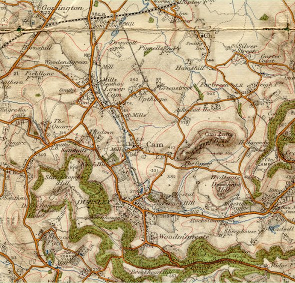
| Dursley and Cam - Ordnance Survey Map, 1 inch to 1 mile (1907) | ||
 |
||
|
This comparatively early Ordnance Survey map demonstrates the totally rural nature of the Dursley area at the beginning of the 20th century. There is no significant development off the main tributaries into the town, Uley Road, Woodmancote and Kingshill Road and everything is concentrated very much in the town centre area. Cam and Dursley have completely distinct identities although connected by the Dursley branch of the Midland Railway which is shown making its way to Long Street from Coaley Junction, passing as it does, the mills along the Cam valley. Other items of note include the Workhouse in the Boulton Lane area and
the estate of Kingshill House. The significance of the roads is also inteesting,
Nunnery lane is shown as a more important road than today whereas Hill
Road is shown as a very minor track. |
||