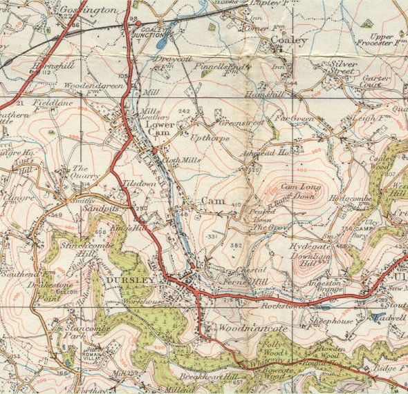
| Originally
published in 1919 but revised with more recent information, this map actually
reveals little development in the town compared with the 1907
map. The Garden Suburb estate has been built as housing for workers
at R.A. Lister
and The Knapp is now shown as a proper road rather than just a track. The
railway is indicated as "L.M & S.R" for the London Midland
and Scottish Railway following the grouping in 1923 and the stations are
much more clearly marked. Other than that though life appears to have moved
at a very slow pace. |