
|
|||||||||
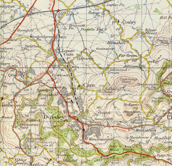
| Dursley and Cam - Ordnance Survey Map, 1 inch to 1 mile (1963) | ||
 |
||
|
Reproduced by kind permission of Ordnance Survey. © Crown Copyright NC/02/3723. Containing minor revisions from an edition originally published in 1953,
this map does show some real change in the town although not reflecting
everything which has happened in the intervening years. The works of R.A.
Lister have expanded along the railway which is now shown as closed,
having seen its last passengers in 1962. Castle Street is shown for the
first time although it has not yet been built to its final design. The
L.J. Watts estate together with Kingshill Park, Blackboys and Kingsway
areas are indicated and in Cam there is evidence of development near The
Quarry and Draycott. |
||