
|
|||||||||
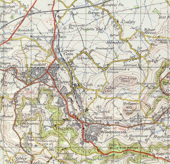
| Dursley and Cam - Ordnance Survey Map, 1 inch to 1 mile (1967) | ||
 |
||
|
Reproduced by kind permission of Ordnance Survey. © Crown Copyright NC/02/3723. Significant development is evident in this map compared with previous
editions. The Rangers and "Poets" estates off Woodmancote
are shown and Woodland Avenue and Westfields are indicated as complete.
In Cam, the Woodfield area and the streets around The Drive are heavily
built up, a sign of things to come. The railway is still shown in existence,
although by now a goods only line, serving R.A.
Lister and the mill of Hunt & Winterbotham. Indicated for the
first time, although having been in existence for many years, are the
works of Mawdsley's
on Uley Road. |
||