
|
|||||||||
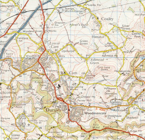
| Dursley and Cam - Ordnance Survey Map, 1 inch to 1 mile (1976) | ||
 |
||
|
Reproduced by kind permission of Ordnance Survey. © Crown Copyright NC/02/3723. The engineering works of R.A. Lister have taken on a new significance and show signs of expansion, probably due in large part to the removal of the railway line which allowed the two halves of the site to be properly integrated. Other development in Dursley is somewhat constrained apart from Castle Street which is indicated in its final form making a head on junction with May lane. In Cam there is evidence of further building in the Tilsdown area. |
||