
|
|||||||||
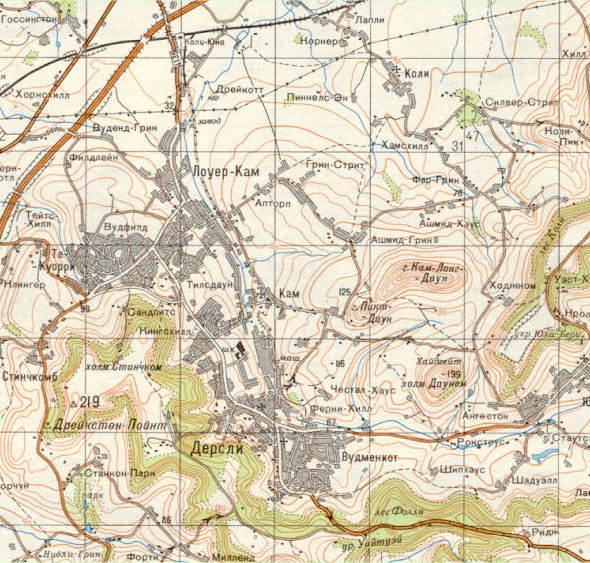
| Dursley and Cam - Soviet Red Army Map, 1:50000 (1981) | ||
 |
||
|
This map makes fascinating viewing as it presents a view of a familiar area in a guise which is totally unfamilar, through the eyes of what was then a foreign enemy. Following the Second World War, the Soviets put enormous effort into mapping potential enemy territory and this demonstrates the lengths to which they went. Mapping was to a very high standard, in colour with cyrillic script and all were extremely accurate, often containing sensitive information which was lacking from domestic versions. The maps were produced in the early 1980s before the breakup of the Soviet Union and conform to the usual Warsaw Pact specification for military topographic maps using the Krassovsky/Pulkovo system rather than the UK National Grid. They also carry the standard Gausse-Kruger military grid which would have allowed them to be used by artillery. It is sobering to think that they would have enabled the Red Army to find their way to even the smallest hamlet. One inconsistency which does appear on this map is the existence of part
of the Dursley Branch Railway, as
far as Cam, even though the line was actually taken up in 1970. Apart
from that though, everywhere seems to be shown just as expected. |
||